June 12
While I’ve got Garmin chartplotters at both the upper and
lower helms, we use a Navionics app on a Samsung pad almost exclusively for our
actual route plotting and navigating. I
like the sonar charts feature which do a better job of showing the latest depth
contours and the auto route feature is easy to use and usually very
accurate. It’s not infallible and this
leg from Isle of Hope to Beaufort was a classic case and why you always need to
double check the routes before heading out.
The auto route simply wouldn’t take the ICW route using the Wilmington River
and instead showed going the opposite direction down river and out into the ocean. Then
pass the Savannah River entrance and finally coming up the Broad River/Port
Royal Sound and into Beaufort. I finally had to reset my programmed boat draft
from 5’ to 4’ and then it showed the ICW route. Weird thing was we left at low tide and
never saw less than 8’ under our keel. The other oddity was traversing Skull Creek
behind Hilton Head Island where it suggested taking a shallower creek rather
than staying on the deeper ICW. We just
ignored that suggestion. In any case,
after getting all the routing the way we wanted the trip went just fine. A 7-hour
travel day so a longer time at the helm than we’ve had in a while.
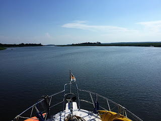
The start of another beautiful day on the water
Leaving Isle of Hope we went upriver and were soon entering
into the outer reaches of Savannah. We
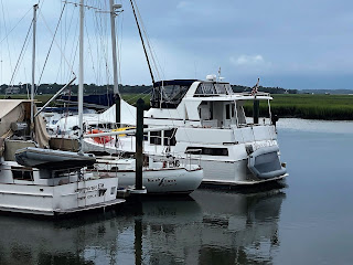
passed Thunderbolt Marina which is well known as a storage and repair facility for
larger yachts. They had a nice
collection of them tied up in the back area.
Made the 75’ yachts tied up on the outside look rather ho-hum. Next,
we passed the Hinckley of Savannah yard.
Had to snap a picture as we passed by for my brother who is working this
summer at their main yard up in Maine.
Megayachts tied up Thunderbolt
75' Marlow Yacht makes me drool.
But nothing special at Thunderbolt when compared to the megayachts.
Hinckley with a custom colored hull at the service yard
Next milestone was crossing the Savannah River. All our guidebooks mention being very careful
here with all the oceangoing tankers and cargo ships going up and down
river. None issue for us – didn’t see a
one. After making it safely across we
were out of GA and back in SC and getting ever closer to our home port.
Zipped around Daufuskie Island and across Calibogue Sound
headed for Hilton Head. We could see
the classic red and white striped lighthouse that marks Harbor Town Marina off in the distance but kept on going. We stopped there years ago when bringing a boat from SC to Jacksonville. The 30' boat we had at the time was docked behind Greg Norman's big sportfishing boat and looked like it was his tender. Lots of tourists out enjoying the water zipping
around on their rental jet skis or taking parasailing rides. Back to civilization for sure requiring a
keen lookout.
Workboat in a Flotilla of remote control sailboats as we pass Hilton Head
As we were coming around the northern tip of Hilton Head
Island and getting ready to cross Port Royal Sound, we were greeted by a pod of
dolphins who were intent on surfing our bow wave. We must have been going a speed that was just
right for them because they stayed with us for quite a while. At one time we had 4 of them being pushed
along on the same side of the bow. As we
approached the open waters of the sound they finally departed. We figured it
was a nice “Welcome back to SC” gathering.
No matter how many times,,,,
they come and play on your bow wave....
we never get tired of watching!
The Port Royal Sound crossing was a little
bumpy but nothing uncomfortable. After
being in fully protected waters for so long any waves felt odd. Checked our Windy app and it was reporting 2’
seas with a 4 second period, so nothing of concern, just a reminder to check ALL
the forecasting tools. Winds, rains, temperatures, wave heights, tides,
currents, etc.
After crossing the sound
it was a lazy run up the Beaufort River pass Parris Island (home of the marine training
base) to town. We throttled down a bit
to make our arrival at slack low tide.
We had hoped to stop at the Beaufort Marina right in town but they were
booked solid. We’re continuing to find marinas
are full as lots of boaters who normally would have moved north by now have simply found a place to stop and are
keeping their boats at rest while awaiting
whatever finally happens with COVID-19. We
were able to get a slip for 2 nights across the river at Lady’s Island Marina. A nice smaller marina that has been very accommodating. Tom, the dockmaster, even knew the reference to "The Princess Bride" movie when we hailed him with our boat name. One of the few places we’ve stayed lately that
still has courtesy cars to use. Clean
restrooms, nice boaters lounge, free washers and several restaurants and grocery
stores within walking distance. A little
bit of a walk but still very doable to get across the bridge and over into the very
charming historic district.
"As You Wish " settled in her slip at Lady's Island Marina
Sun setting over the town of Beaufort
DAY 2
Sort of a bust today. Rain, rain and more rain had us mostly boat bound all day except for a quick trip around town using the courtesy car. Spent some time planning our final two days of travel. We'll anchor out tomorrow and arrive at St. Johns Yacht Harbor around noon on Sunday during slack tide for our official wake crossing. Was able to walk over to a nice bakery this AM before the rain started for some fresh croissants and pastries that were pretty yummy. Need to come back here another time when we've got better weather and more time to walk around and explore. The rain ended towards dusk and we got treated to one of the more special sunsets we've seen. Just as the sun was headed to the horizon it got absorbed by some clouds and we figured the rest of the sunset would be a bust. But the colors just kept getting more intense.
Intense colors after the sun went down
Journey for June 11


Wow! Just...Wow!! SL
ReplyDelete